31.jpg)
|
|---|
|
|
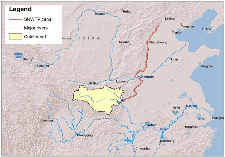
Catchment Sensitive Farming Alert System The ‘Catchment Sensitive Farming Alert System’ project is co-funded by the UK Science and Technology Facilities Council (STFC) as part of theUK-ChinaNewton Agri-Tech Programme. The main objective ofthe project is to develop the use of remote sensing data, particularly from the new Sentinel satellites, to promote more sustainable farming practice in China. Catchment sensitive farming has been successful in UK farming, with farmers adjusting their practices to provide environmental benefits. This is particularly relevant to China where the severity of some of the drought, water pollution and flooding problems is significant. The aim of the project is to identify ways of maintaining and improving crop production, while at the same time introducing sustainable practices that reduce water pollution effects and flooding risk. The DanjiangkouReservoir catchment in central China has been chosen as the study area, since it is a large catchment that supplies water to the north, including Beijing, as part of the South-to-North Water Transfer Project (Figure 1). The Chinese partners, the Institute of Remote Sensing and Digital Earth of the Chinese Academy of Sciences (RADI), and the Agro-Environment Protection Institute of the Ministry of Agriculture, China (AEPI), are already involved with the implementation of water quality measurement programmes within the Danjiangkou Reservoir catchment.The project will build on this and other research into the impacts of land use on water security in this strategically important catchment, in terms of both water quality and quantity, by modelling the relationship between aspects of agricultural practice that can be derived remotely from satellites and water quality.
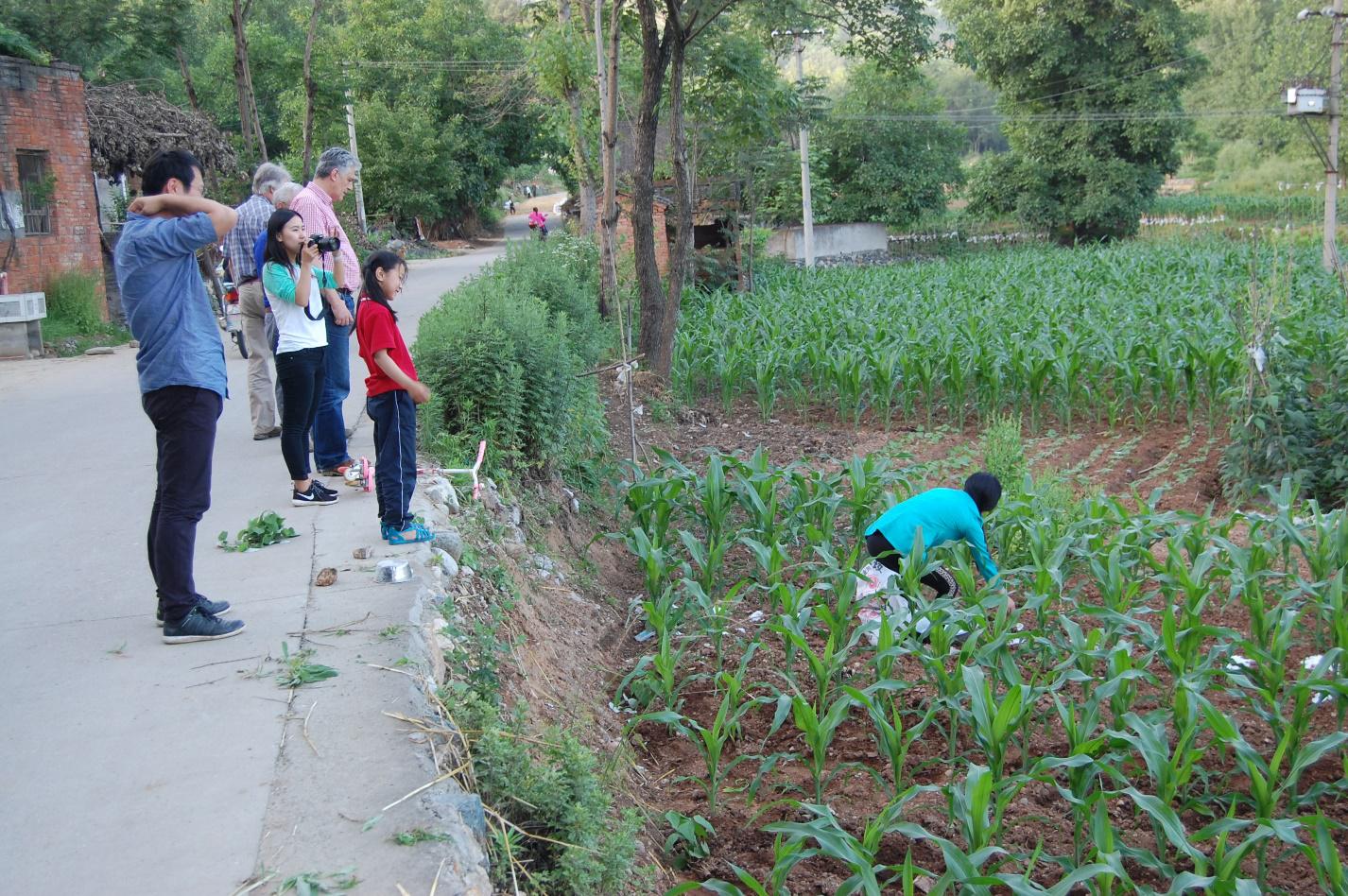
A large remote sensing data collection programme is planned, including the acquisition of time series of Sentinel, Landsat and Chinese satellite data. Remote sensing research will focus on the development of the use of Copernicus Sentinel data for crop mapping and monitoring of cropping systems to better understand the makeup of individual sub-catchments. The Sentinel-1 radar satellite provides frequent repeat data around the globe, and Remote Sensing Applications Consultants Ltd (RSAC) has developed a methodology to produce annual crop maps for European agricultural areas based on these. One aim of the current work is to further this development through collaboration between UK and Chinese research and application specialists, with a view to testing and demonstrating the accuracy of crop classification that can be achieved in different agricultural regions of China. Catchment analysis of water flow and water quality will be carried out by Cascade Consulting in relation to agricultural pollution and farming practice measures, considering the catchment as a whole as well as specific sub-catchments. The potential improvements in water quality likely to result from the implementation of farming practices and measures to deliver good water quality and Sustainable Intensification of agricultural production will be assessed by Reading Agricultural Consultants (RAC) working together with stakeholders. Catchment sensitive farming in the UK, the USA and Europe has established that a very large number of measures can be applied successfully in a range of circumstances depending on permanent physical conditions and transient land use. The measures include changes in cropping and fertilisation practices, arable reversion to grassland, establishing break crops, changing cultivation practices, planting woodland strips and establishing in-field grass buffer strips. A kick-off meeting involving all project participants was held at RADI in Beijing on 3 June 2015. Between 5 and 8 June 2015, team members from RSAC, RAC, Cascade and RADI conducted a reconnaissance tour of the Danjiangkou Reservoir catchment, looking at agricultural practices and hydrological features (Figure 2). In addition, data was gathered for validation of the 2014 land cover map produced by RADI.
|
|||||||
|---|---|---|---|---|---|---|---|---|---|
| Copyright© 2008 SAIN. All right reserved. |
|---|